
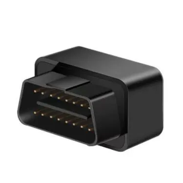
 4G OBD GPS Tracker D08-4G
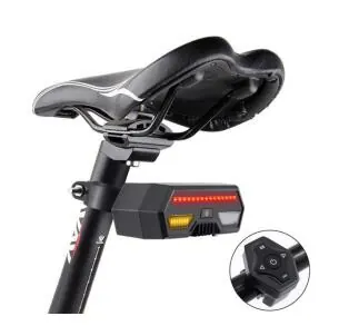 4G Bike GPS tracker D16
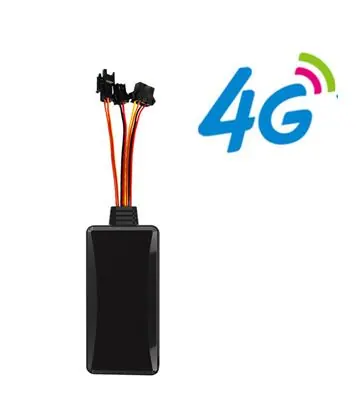 4G GPS tracker D06-4G
Asset GPS Tracker
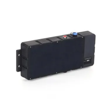
Gotop A70-B Solar Powered Satellite Communication GPS Tracker
The Gotop A70‑B represents the next generation of remote asset tracking technology. Meticulously designed for assets operating beyond terrestrial network coverage, the A70‑B integrates both 4G LTE full‑network wireless communication and satellite IoT communication via the on‑orbit Tianqi constellation. This dual‑mode capability ensures you can track your assets anywhere on Earth – whether within cellular range or in the most remote oceans and wilderness areas.
The device features a high‑capacity 30000mAh rechargeable battery paired with a monocrystalline silicon solar charging panel (6.6W charging power, up to 1.5A charging current), enabling autonomous, maintenance‑free operation in off‑grid environments. The A70‑B employs the advanced 400‑GM10 dedicated satellite IoT communication module from Guodian Gaoke, supporting short message communication with the Tianqi constellation. With a maximum RF transmit power of 2W and receive sensitivity of -138dBm, the module utilizes Chirp spread spectrum technology to achieve reliable communication over distances exceeding 1500km, with maximum instantaneous power consumption below 6W.
The terminal integrates industrial‑grade, highly integrated fully built‑in antenna design and features a built‑in 3‑axis sensor with intelligent power‑saving wake‑up operation. Advanced features include low battery alarm, disassembly alarm, SOS alarm, over‑speed alarm, capsizing alarm, and real‑time global location statistics. When paired with the Gotop global positioning service platform, the A70‑B enables real‑time acquisition, tracking, positioning, and status monitoring of remote vessels and off‑grid assets – providing complete visibility regardless of location.
| Parameter | Specification |
|---|---|
| Model | A70-B |
| Power Supply | Built‑in Battery (Solar Charging) |
| Operating Voltage | DC 5V |
| Operating Current | 3.7V / Average 50mA |
| Standby Current | 3.7V / Average 3mA |
| Battery Capacity | 30000mAh (3.7V Polymer Battery) |
| Solar Panel Power | 6.6W (Max Charging Current 1.5A) |
| Operating Temperature | -20℃ to 75℃ |
| Storage Temperature | -30℃ to 80℃ |
| Operating Humidity | 10% – 85% RH (Non‑condensing) |
| Satellite Communication Band | 399MHz – 401MHz |
| Satellite Modulation | Chirp Spread Spectrum Technology |
| Satellite Receiver Sensitivity | -138dBm ±1dBm |
| Satellite Transmit Power | ≤33dBm (2W) |
| Satellite Transmission Distance | 1500km @ 2W |
| Satellite Transmit Current | ≤1500mA (Max Instantaneous) |
| Satellite Receive Current | ≤20mA |
| Satellite Standby Current | ≤15uA |
| Communication Module | SIMCOM A7670SA / A7670E |
| 4G LTE Bands | FDD B1/B3/B5/B7/B8/B20 / B1/B2/B3/B4/B5/B7/B8/B28/B66 |
| 2G GSM Bands | 850/900/1800/1900MHz |
| SIM Card | Micro SIM Card |
| Communication Antenna | Built‑in FPC Antenna |
| Positioning Module | Zhongke Micro AT6558 |
| Positioning Systems | GPS + BeiDou |
| Cold Start Time | Average 32 seconds |
| Warm Start Time | Average 1 second |
| Tracking Sensitivity | -162dBm |
| Positioning Accuracy | < 10m (1σ) |
| Time Accuracy | < 30ns (1σ) |
| Speed Accuracy | < 0.1m/s (1σ) |
| Satellite Channels | 64 |
| Maximum Speed | 515m/s |
| Maximum Height | 18000m |
| Dimensions | 37.5cm × 14.3cm × 4.8cm |
| Material | ABS Plastic |
| Net Weight | 1.80 KGS |
| Waterproof Rating | IP68 |
Specifications on this page are the ones published by GOTOP for this model. Ask us before ordering if you need a band, battery or protocol that is not listed.
Related Products
Small orders are welcome, and our engineers can change firmware, protocol or housing to match your platform.
FAQ
The A70‑B adds satellite IoT communication capability (Tianqi constellation) to the standard 4G LTE connectivity of the A70‑A. This means the A70‑B can transmit location data via satellite when no cellular network is available, making it ideal for tracking assets in the middle of the ocean, remote wilderness, or other areas without terrestrial network coverage.
The A70‑B utilizes Chirp spread spectrum technology with a maximum RF transmit power of 2W and receiver sensitivity of -138dBm, achieving reliable communication distances of over 1500km via the on‑orbit Tianqi satellite constellation.
The A70‑B requires satellite service credits to transmit data via the Tianqi constellation. Satellite service is available at US$0.10 per position transmission. This pay‑per‑use model allows you to manage costs based on your actual tracking needs.
Yes. The A70‑B supports international LTE FDD bands (B1/B2/B3/B4/B5/B7/B8/B28/B66) and global GSM bands, making it suitable for deployment in most regions worldwide. The Tianqi satellite constellation provides global coverage for satellite communication.
Yes. The A70‑B works with the Gotop global positioning service platform and companion mobile app, providing real‑time location tracking, geofence alerts, and status monitoring directly from your smartphone or computer – whether the device is connected via 4G or satellite.
The A70‑B features built‑in offline data storage with blind‑spot retransmission. When in areas with weak or interrupted wireless signals, the device temporarily stores operational data in its FLASH memory. Once wireless signal is restored (via either 4G or satellite), the stored data is automatically retransmitted to ensure no data loss.
Yes, the A70‑B has an IP68 waterproof and dustproof rating, meaning it can withstand continuous immersion in water. It is specifically designed for marine environments and extreme outdoor conditions.